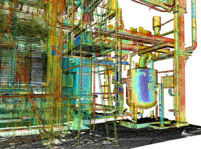
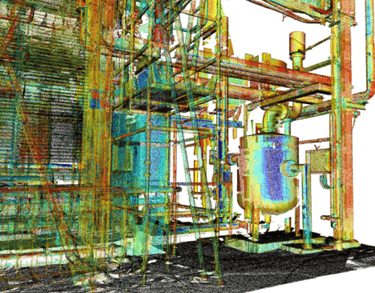
3D Scanning
At Dome Construction, our expertise ensures precise, reliable data for even the most complex projects, serving industries such as construction, logistics, and oil & gas. We combine advanced technology with deep industry knowledge to help clients plan smarter, work safer, and build with confidence.
Our point cloud surveying services capture ultra-precise, high-resolution 3D data to support structural assessments, asset management and design validation
This technology is especially valuable for complex environments such as industrial plants, where safety, accuracy and efficiency are critical
Key advantages include:
Creation of digital twins for complex facilities
Accurate design data for modifications and upgrades
Clash detection to prevent costly errors before work begins
Safer inspections in hazardous or restricted areas
Fast, detailed documentation to streamline maintenance planning
Our point cloud surveying solutions are tailored to meet the demanding requirements of a variety of use cases in construction, plants, facilities and logistics:
Highly accurate 3D models of intricate piping systems and structural layouts
Technical support for maintenance, retrofits and safety audits
Seamless BIM integration for creating and managing digital twins
High-precision change monitoring over time
Comprehensive quality inspections and assurance reporting
Drone Technology
Our advanced drone-powered surveying solutions combine high‑resolution aerial imagery, LiDAR scanning, and 3D laser technology to capture every detail of your site with unmatched speed and accuracy.
Drone Technology for Smarter, Faster project delivery
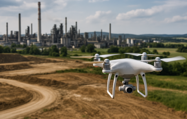
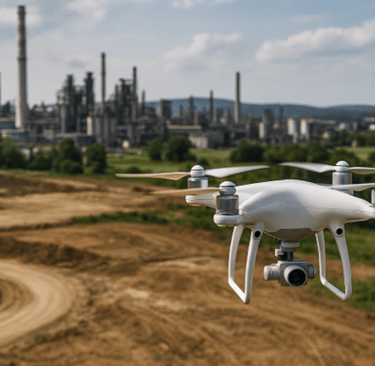
By transforming the drone data into precise 3D models, we give you a complete, real-time view of your assets and infrastructure, enabling you to:
Plan with confidence using accurate spatial data
Identify opportunities and constraints before work begins
reduce costly delays through early clash detection
Minimise site visits and improve safety in hazardous areas
Whether you're managing a brownfield upgrade, planning a new build or conducting ongoing asset monitoring, our drone technology delivers the insights you need to make informed decisions, streamline workflows, and keep your project on track